An Insider’s Guide to Visiting Mount Rainier National Park
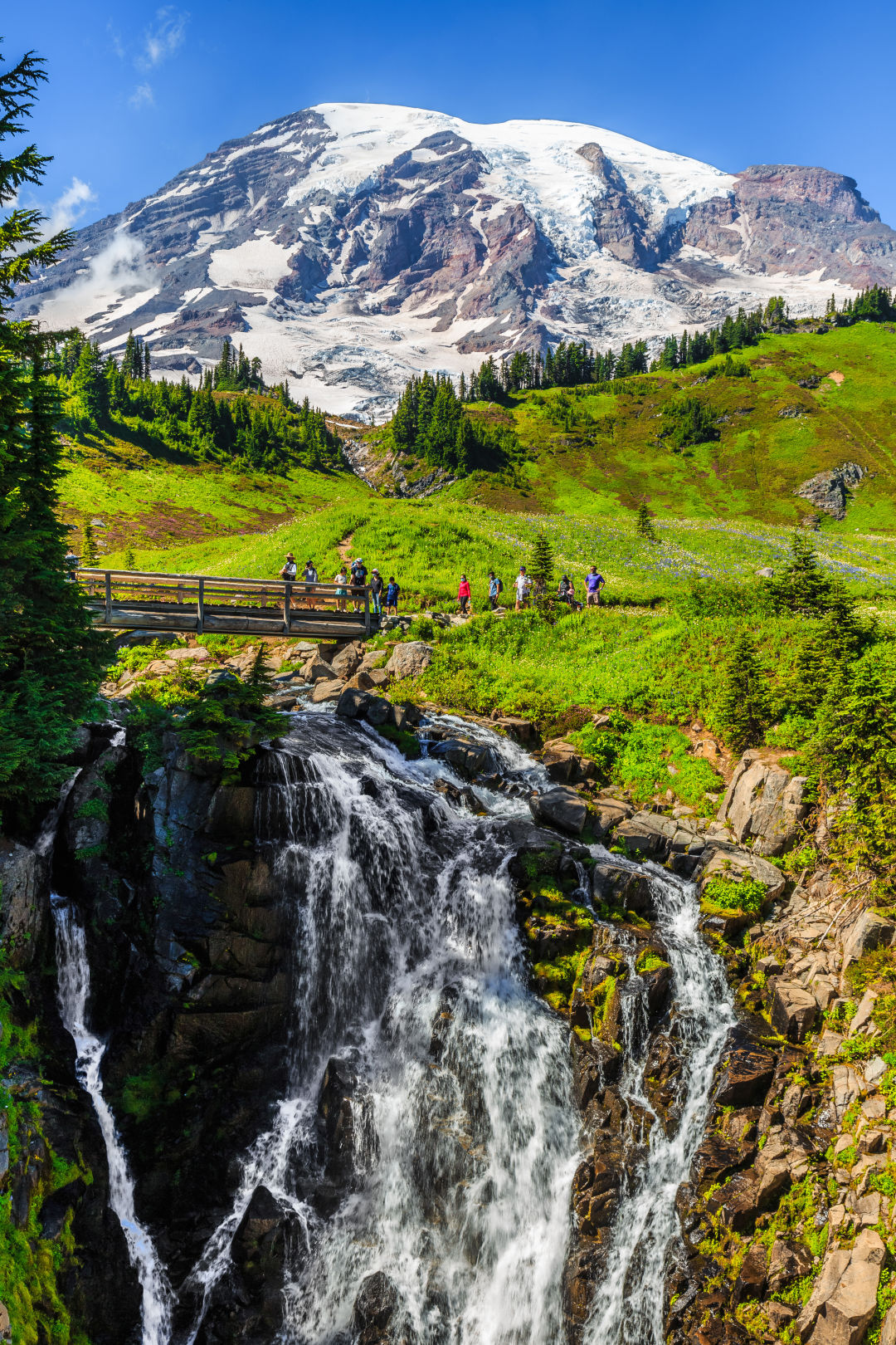
Myrtle Falls tumbles through the meadows at Paradise.
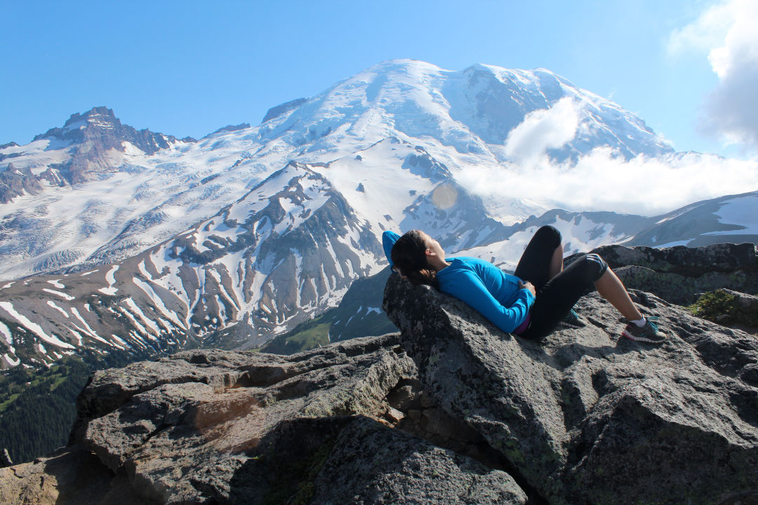
It’s hard not to rubberneck at the massive Mount Rainier. It’s at turns regal and coy, reassuring and ethereal; always 60 miles southeast of downtown Seattle and always squatting 14,410 feet high. People have been poking around, sleeping next to, and sitting atop Mount Rainier for centuries. Its subalpine meadows, thick with wildflowers, were the hunting grounds for Native tribes. Today millions of visitors enter the national park annually to hike, camp, and drink in the grandeur of our giant.
All of the park’s main visitor areas—Paradise, Sunrise, and Longmire—offer hiking and sightseeing, though the beautiful roads that link them boast plenty of unforgettable views too. Find visitor information at the national park website or from the park entrance stations; fees are $30 per car. Note that some facilities, roads, and even entrances are seasonal.
Starting in summer 2024, peak times require advance planning to visit most parts of the park. Called the Timed Entry Reservations, they are bookable online for times between 7am and 3pm from May 24 through September 2 for the Paradise corridor and July 4 through September 2 for the Sunrise corridor. Each reservation is $2, released in batches in the spring and then daily at 7pm the night before each reservable day. The Mount Rainier National Park superintendent calls the pilot project "a grand experiment."
Jump to an Activity:
What to Do / Where to Hike / Where to Stay / What to Know
What to Do
Paradise
The name is no exaggeration. When the wildflowers bloom at Mount Rainier’s biggest visitor area, the meadows are as lush as any celestial kingdom. The Paradise Inn, Henry M. Jackson Memorial Visitor Center, Nisqually Glacier overlooks, and climbing center draw so many tourists that the park is considering a shuttle service to ease congestion on summer weekends.
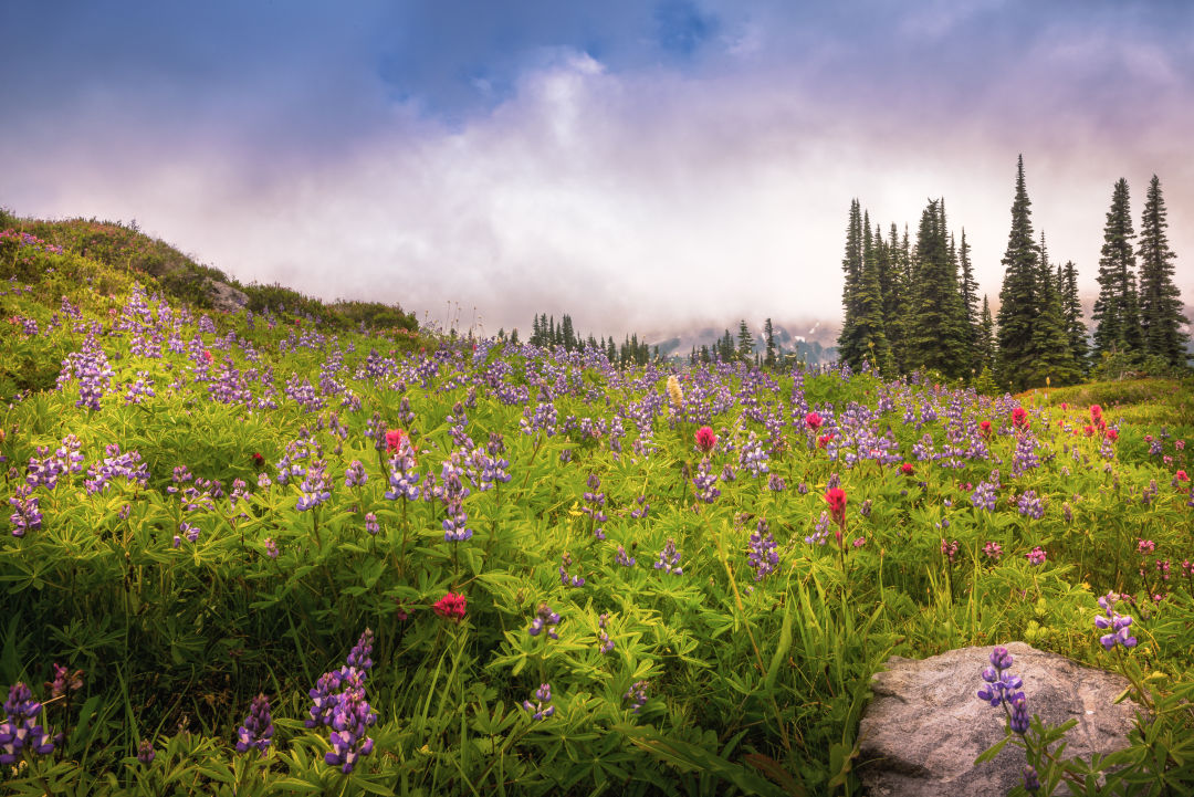
Wildflowers take over around Paradise in late summer.
Image: Mills / flickr CC
Sunrise
The morning sun puts on a show at the park’s northeastern hub, which at 6,400 feet is the highest spot you can drive to in the park. Sunsets aren’t half bad either. There are vistas of the Emmons and Winthrop glaciers, and down below is the deep V of the White River Valley.
Longmire
Open year-round, the complex of administrative buildings sits on the Nisqually River at half the elevation of Paradise, meaning it’s snow-free for more months of the year, ideal for short forest rambles. Next to the museum and general store, the wide front porch of the rustic National Park Inn faces a brilliant view of Rainier—when the mountain is out, of course.
Carbon River
Floods washed out the road shortly past the park’s northwestern entrance, but bikers and hikers can trek five miles into the Ipsut Creek campsites. A summer-only dirt road five miles south, Route 165, leads to another walk-in campground at Mowich Lake and trails that lead to a fire lookout and alpine meadows.
Crystal Mountain
The ski area, just outside park boundaries, transforms in summer to an outdoor sports mecca, turning downhill slopes into hiking and biking trails. The state’s highest restaurant, the Summit House, has a mountain view at the top of the gondola.
Ashford
The town is little more than a loose string of rental cabins, mountaineering shops, and restaurants, but it’s home base for much of the park’s outdoor activity. Located near the Nisqually Park entrance, make a stop for pizza at Rainier Basecamp Bar and Grill or famous blackberry pie at Copper Creek Inn.
Where to Hike on Mount Rainier
Burroughs Mountain
7 miles | Sunrise
Above the trees and in the tundra, these ridges resemble a moonscape. Besides the First, Second, and Third Burroughs mountains, hikers can sometimes see avalanches on Rainier’s flanks. The catcalls coming from the rocks? They’re marmot whistles.
Hiking on Second Burroughs Mountain.
Image: Nicole June / Flickr CC
Grove of the Patriarchs
1.1 miles | Ohanapecosh
The granddaddy of interpretive trails is a gentle saunter through a patch of hemlocks, cedars, and Douglas firs as ancient as 1,000 years old. The old dudes are so big—some are 50 feet in diameter—and can be viewed from a boardwalk trail that starts just past a not-too-swingy suspension bridge. (Note: storm damage closed the trail in 2021 and it is expected to reopen in 2027.)

The Grove of the Patriarchs trail includes a scenic suspension bridge.
Eagle Peak
7.2 miles | Longmire
This 2,955-foot climb is more intimidating than the popular Pinnacle Peak, another snowy summit in the serrated Tatoosh Range south of Paradise. But the grade is moderate to this saddle, and it offers a dizzying overlook of the Nisqually Valley with in-your-face views of the mountain.
Rampart Ridge
4.6 miles | Longmire
Among the first trail loops to be snow-free each spring, this ridge offers the best seat in the house when the mountain is out. Switchback up to an overlook of Longmire, then look for a rocky clearing about a half mile later—it’s like a booster seat to a Rainier panorama.
Skyline Trail
5.5 miles | Paradise
The start of this uphill slog is paved, all the better to preserve the lush subalpine meadows. Climbers heading to Camp Muir will share the trail until the day hikers curve up some 1,500 feet above Paradise to Panorama Point, then down past waterfalls at the end of the loop. The views of the craggy Tatoosh Range are spectacular from Panorama Point, but so is the fact that there’s a remote solar-powered bathroom built into the mountain.
Naches Peak Loop
3.4 miles | Chinook Pass
One of the few to straddle the national park boundary, this trail winds around Highway 410 to Yakima. The moderately strenuous loop provides killer mountain views when done clockwise, and huckleberry bushes are heavy with fruit in late summer.

Escape the visitor center crowds on the Naches Peak Loop Trail.
Image: shutterstock by Dmitry Kovba
Silver Forest Trail
1.6 miles | Sunrise
Most hikers flock toward the mountain, but this near-level trail meanders east from Sunrise. The sun-bleached branches are bare because of a long-ago fire, but the ghost forest is now carpeted with wildflowers. Across the deep White River Valley is an excellent view of the Emmons Glacier.
Where to Stay at Mount Rainier
Cougar Rock Campground
Located between Longmire and Paradise, it offers 173 sites (plus five just for large groups) of centrally located convenience. Reserve online.
White River Campground
Some sites back up onto the titular waterway, but even better: All 112 of them are first come, first served, so it’s the only landing pad for car campers without reservations. Find it near the Sunrise visitor area on the mountain’s northeast side.
Ohanapecosh Campground
The park’s biggest site sprawls across almost 200 campsites in thick old-growth forest. Named by the Upper Cowlitz who used this riverfront acreage, it’s also bookable online.
National Park Lodges
Two hotels sit inside park boundaries, both on the south side of the mountain. Recent renovations have spruced up the circa-1916 Paradise Inn, set among alpine meadows, but its true charms are the unchanged stone fireplaces on both ends of the massive great room. Under the steep roof—all the better to shake the record snowfall—are dormer windows, snug rooms, and thick wooden beams. The National Park Inn in Longmire offers a foresty vibe, complete with lounge-worthy front porch, and is open year round.

Paradise Inn's peaked roof is a classic example of what the park service calls “parkitecture.”
Loge Alta Crystal
Sometimes a tent isn't going to cut it. Near the northeast corner of the park—not far from Crystal Mountain—this resort includes all creature comforts, minus the creatures. A heated outdoor pool and hot tub sit near the front of the property, while an isolated honeymoon cabin is discretely tucked into the woods.
Wellspring Spa
The best log cabins on this woody compound in Ashford have a full kitchen, a Jacuzzi tub, feather beds, and fireplaces made of massive river rocks; another has a private Zen garden. Outdoor hot tubs also dot the property.
What to Know about Mount Rainier
Read the secret stories of Mount Rainier, and how to make the most of a national park vacation.
Mount Rainier’s Red Fox Menace
Red foxes were once a prized sighting at Mount Rainier. Now they’re cause for worry.
How to Take the Ultimate Mount Rainier Photo
How pros photograph the mountain—angles, locations, time of day, and more.
The Brothers Whittaker
Whenever we play in the mountains, we owe a debt to Jim and Lou Whittaker. The Seattle twins conquered Mount Rainier, Mount Everest, and REI, then made mountaineering our signature sport. Northwest lives don’t get bigger than this.

Shelters at Camp Muir are built to withstand the weather at 10,000 feet.
Image: Shutterstock by CSNafzger
Camp Muir: Rainier’s Temporary Town at 10,000 Feet
A day and a night at the home base for climbers, guides, and rangers, halfway up a volcano.
Mount Rainier’s Real Name
Local Indian tribes lived around a mountain they called Tahoma for centuries, and their legacy struggles to hold on.
12 Ways to Do Rainier without Actually Entering the National Park
Beyond the park boundaries sits a wealth of small-town charm, not to mention lesser-known hikes and stellar views of that big lump of volcano everyone loves so much.