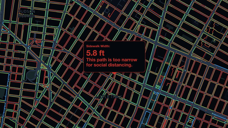
Amid an ongoing debate about whether certain streets should be closed to vehicles and designated for pedestrians, one urban planner has created a visualization mapping out the width of every New York City street, showing that it is "extremely difficult, if not impossible, to maintain social distance" while walking narrow avenues.
"As an urban planner, I've always been hyper-aware of how crowded, narrow city streets can affect pedestrian's quality of life and safety," Meli Harvey told NBC News. "The pedestrian experience and the ease of walking around a city has a big impact on people's ability to access amenities or go to work. I've always questioned why in some cities it's a lot easier to walk around than others, particularly for those who may use a wheelchair or have different abilities."
Harvey, a NYC resident for nearly 10 years and a senior computational designer at Sidewalk Labs, an infrastructure company, began working on the visualization more than a year ago — well before the city became an epicenter for COVID-19. Yet as the coronavirus became a growing threat and social distancing measures were adopted, her work in this area became more of a priority.
"I wanted to contribute to the discussion of how we're using public space during the pandemic," Harvey said. "I saw that what the public needs in terms of what we're trying to get out of public space have changed dramatically. When the lockdown started, the need for moving around in cars became much more reduced and the need for keeping socially distant became much more important."

According to Harvey, data regarding sidewalk widths specifically is sparse — if not nonexistent — yet data about streets "as they pertain to vehicles," including how many lanes and traffic lights intersections may have, are more readily accessible. Using data from New York City's Sidewalk dataset, Harvey developed code that measured how wide each New York City street is.
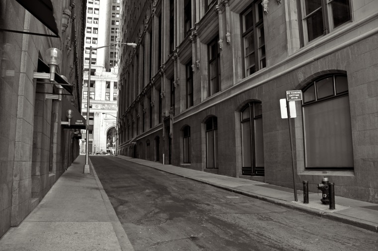
While the data she used is from 2014, the most recent year available, and may "be out of date at this point," Harvey is confident in stating that it's nearly impossible to maintain social distance while walking, particularly on older streets in downtown Brooklyn and the Financial District. She said that for a while, city planning evolved and streets became wider, but that in the early last century, sidewalks, particularly those in the outer boroughs, "started to get really skinny" to accommodate growth and prioritize drivers. Harvey noted that many pedestrians have taken to walking in the street to avoid congestion on these narrow streets, which is a dangerous alternative.
This is why some advocates are calling for New York Mayor Bill de Blasio to designate certain streets for pedestrians only. Last month, the mayor announced that he would close several streets to give pedestrians more room to safely travel on-foot, but after a brief debut, the effort was discontinued.
When asked about concerns over the fact that New York City streets remain open to both cars and pedestrians, unlike in other cities such as Oakland and San Francisco where some streets have been closed to drivers, a spokesperson from de Blasio's office directed NBC News to a statement the mayor gave during a news conference Wednesday morning. De Blasio cited "a different culture" in California and a lack of available personnel from the New York City Police Department as to why New York City streets can't be closed in a similar manner to streets in other areas.
"Drivers stop at intersections even if there's no light or stop sign. They stop when people are trying to cross the street even in the middle of the street, a lot of time," de Blasio said of California drivers. "This is a very different culture."
He added that he was "not comfortable with streets being delineated as for pedestrians and just hoping and praying cars don't go on them and pedestrians are going to be safe" and that the NYPD is currently prioritizing the enforcement of social distancing at parks, grocery stores and subway stations.
Harvey said she hopes her visualization can provide data to decision makers and advocates who are thinking about the issue of street closures, and that though the visualization has added relevance in this current era of social distancing, she wants others to consider the issue "beyond the pandemic."
"In general, we've had a problem where we've put so much investment into automobiles that we've hit a limit of how many people can move through space," Harvey said. "There are just fundamental physical limits to how many people can move when everyone's in a car. There are so many other forms of mobility and walking is just one of them. There has to be a refocus on other forms of mobility."

