
This May Be the Most Dangerous U.S. Volcano
Move over, Yellowstone: Geologists are far more worried about a postcard-perfect peak in the Pacific Northwest.
Supervolcanoes sound terrifying, but the risks they pose don’t usually match their fearsome reputations. Yellowstone in particular often makes its way into headlines, as every earthquake swarm or change in geyser activity spawns unfounded rumors of an apocalyptic eruption.
However, ask a volcanologist where the real risk in the U.S. lurks, and there’s a good chance that they will turn their gaze to the Pacific Northwest.
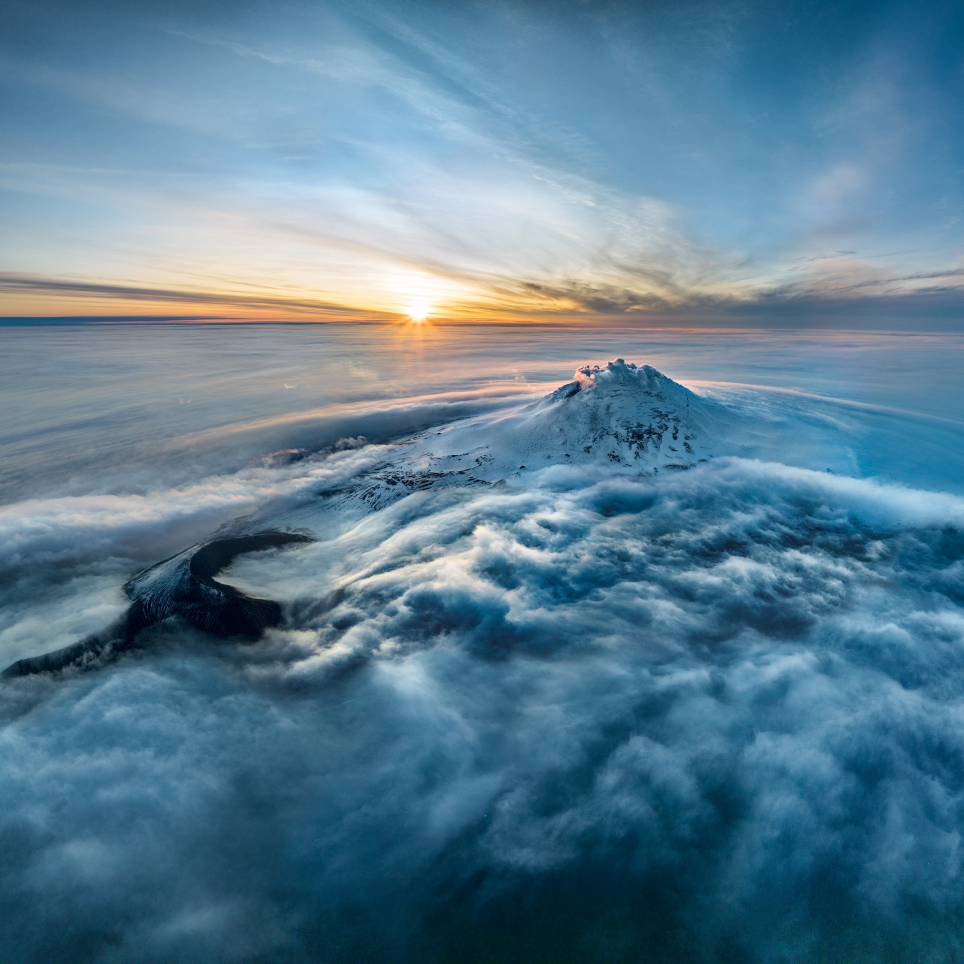
Nestled among the Cascade mountain range sits Mount Rainier, a postcard-perfect natural wonder—and a volcano that causes scientists genuine concern. It’s unclear when it will stir from its long slumber, and there’s no sign that anything is imminent. Nevertheless, a future eruption could cause one of the worst natural disasters in the U.S. (See pictures of the 10 most dangerous volcanoes in the U.S.)
Unlike its infamous cousin, Mount St. Helens, Rainier is not known to be particularly explosive. And yet, Janine Krippner, a volcanologist at Concord University, is unequivocal in her assessment.
“Rainier is one of the most dangerous volcanoes in the world,” she says. “It’s a huge concern.”
America’s Armero?
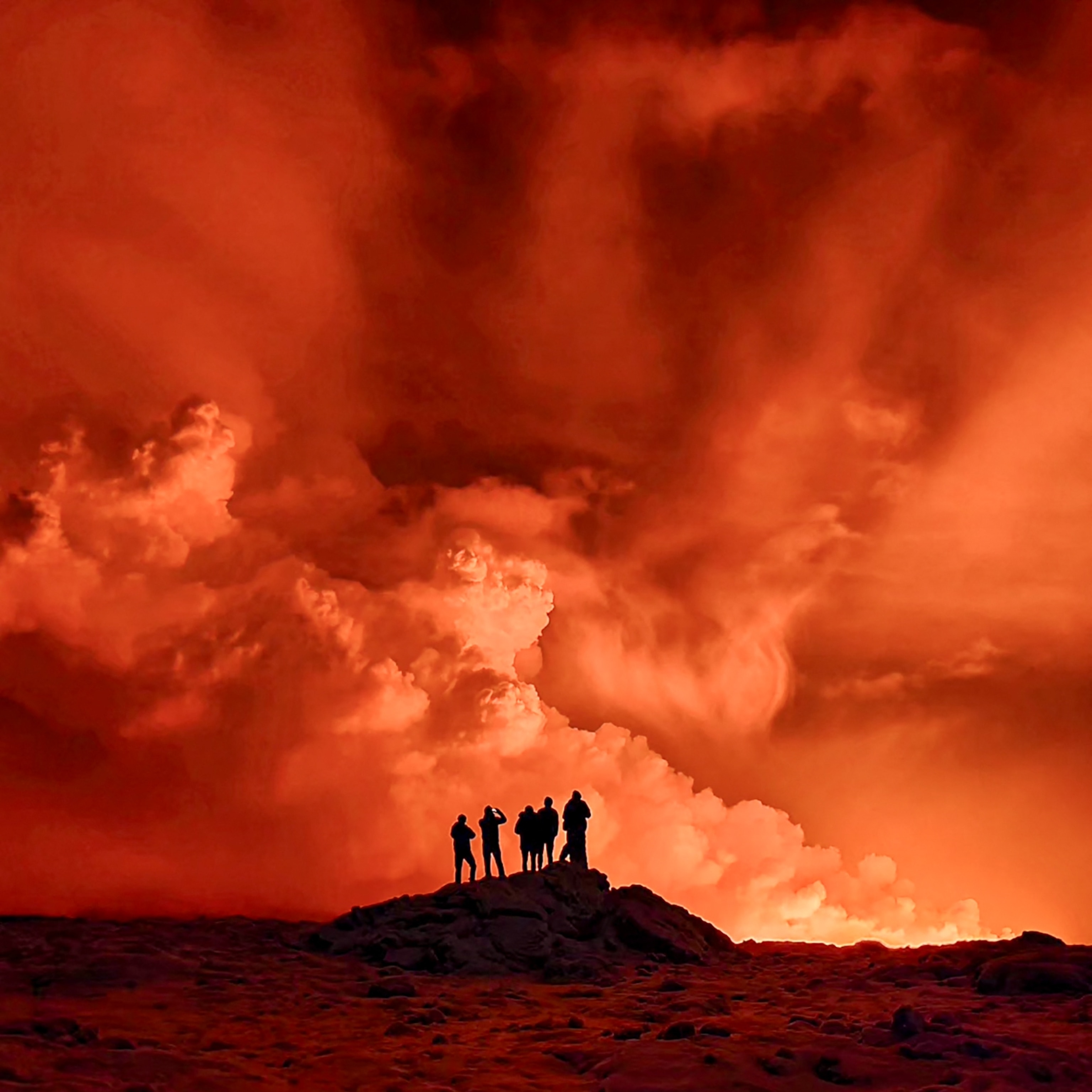
To make the case, Krippner points to Colombia’s Nevado del Ruiz volcano, which experienced a notorious eruption in November 1985. In that event, neither lava nor pyroclastic flows of hot gas and ash were the killer elements. Instead, the paroxysm quickly melted the volcano’s summit glaciers, and fresh floodwaters rapidly entrained and mobilized the loose sediment on the volcano’s flanks.
This activity set off a series of lahars: viscous, violent slurries that rushed down toward the town of Armero at about 30 miles an hour as its residents slept. The town and its inhabitants were smothered within mere moments. The eruption is now known as one of the worst volcanic disasters in human history, killing around 23,000 people.
This volcanic hazard is the reason a future eruption at Rainier could prove to be so deadly. The United States Geological Survey (USGS) has carefully mapped and studied the sleeping colossus, and it’s clear that the valleys on its slopes are perfect for lahar formation, with several suburbs of the Seattle-Tacoma metropolis sitting right in the path of disaster.
“Lahars can lift houses. They can overtake a bridge. They can take the bridge with it,” Krippner says. In the past, lahars from eruptions filled up valleys to heights of almost 500 feet along Rainier’s viridian flanks.
“Imagine if you’re in that valley today,” Krippner says. “Can you climb 150 meters [490 feet] particularly quickly?”
“I do think it is one of the most hazardous volcanoes in North America,” says Carolyn Driedger, a hydrologist and outreach coordinator at the USGS Cascades Volcano Observatory, and one of the world’s foremost experts on Rainier. In addition to the profound economic damage an eruption would cause to the region’s settlements and ports, she cites the large number of people who live in valleys that were inundated by past lahars.
At least 80,000 people sit in zones that future lahars are certainly capable of reaching. If residents aren’t prepared, an eruption at Rainier could prove to be America’s very own Armero tragedy.

Starting From Scratch
But are people prepared? The USGS has a comprehensive plan to communicate hazards and aid authorities, but it’s not yet enough. As Driedger points out, “people don’t associate mud with volcanoes.” This makes conveying the hazards of Rainier incredibly challenging, especially since many people erroneously see the volcano exuding a permanent state of calm.

In recent years, the amount of people moving to the Pacific Northwest has risen significantly, and millions of Americans visit Mount Rainier National Park every year. Both groups, in general, have no experience with or knowledge of volcanic eruptions.


“When talking about Mount Rainier’s hazards, it often feels like we’re starting from scratch,” Driedger says.
Even though Rainier is one of the most heavily monitored volcanoes on the planet, it remains an idiosyncratic monolith. The volcano last shook in 1894-95, when minor explosions reportedly rocked the summit, but it hasn’t really blown its top for at least a thousand years or so.
The next eruption or lahar could occur with little to no advanced warning, and it’s not clear if it’s possible to evacuate so many thousands of people in a matter of minutes. Even if they are fortunate enough to get a warning, people might not heed it. (Also find out why Yellowstone’s supervolcano could rumble to life faster—but not sooner—than thought.)
“There’s this massive misconception that in a disaster, people panic,” Krippner says. “Recent research shows that that’s a rare case. Most often, people don’t react; they freeze, or they shrug the warning off, assuming it’s not that serious.”
It’s also not possible to say exactly how the next Rainier eruption will manifest itself.
“When talking to community groups, I emphasize we could have nothing more than a small steam-based eruption at the summit, or it could be something much larger,” Driedger says. History nevertheless underscores that you only need a moderate blast to melt a large amount of snow and ice, triggering a lahar.
Preventing a Dark Future
Humanity isn’t exactly defenseless against Rainier’s wrath. Three of the four larger river valleys branching down from the volcano have dams, and as other volcano-prone countries such as Japan and Indonesia have demonstrated, those dams could drain their reservoirs and be used to trap incoming lahars—as long as they are constantly maintained.
The Puyallup Valley, however, remains undammed, and creating one in this increasingly populated region any time soon seems unlikely. That, and the presence of weak and easily entrained rock in the valley, makes it the highest risk zone.
A recent study Driedger coauthored explores the multiple ways to mitigate the risks of lahars. Of special note, however, is her team’s emphasis on one particular notion: Such efforts will mean little if volcanologists don’t work closely with local communities and authorities to communicate the nature of the hazards properly.
“Twenty-three thousand lives could have been saved at Nevado Del Ruiz,” Krippner says. “Now, we have the chance to do that here.”
Robin George Andrews is a volcanologist turned science journalist based in London. Although always partial to a Kilauea or Krakatoa, he enjoys other extravagant scientific tales too, from asteroid impacts to climate change. Follow him on Twitter and his website.
Related Topics
You May Also Like


Go Further
Animals
- Fireflies are nature’s light show at this West Virginia state parkFireflies are nature’s light show at this West Virginia state park
- These are the weird reasons octopuses change shape and colorThese are the weird reasons octopuses change shape and color
- Why young scientists want you to care about 'scary' speciesWhy young scientists want you to care about 'scary' species
- What rising temperatures in the Gulf of Maine mean for wildlifeWhat rising temperatures in the Gulf of Maine mean for wildlife
- He’s called ‘omacha,’ a dolphin that transforms into a man. Why?He’s called ‘omacha,’ a dolphin that transforms into a man. Why?
Environment
- What rising temperatures in the Gulf of Maine mean for wildlifeWhat rising temperatures in the Gulf of Maine mean for wildlife
- He’s called ‘omacha,’ a dolphin that transforms into a man. Why?He’s called ‘omacha,’ a dolphin that transforms into a man. Why?
- The northernmost flower living at the top of the worldThe northernmost flower living at the top of the world
- This beautiful floating flower is wreaking havoc on NigeriaThis beautiful floating flower is wreaking havoc on Nigeria
- What the Aral Sea might teach us about life after disasterWhat the Aral Sea might teach us about life after disaster
History & Culture
- Scientists find evidence of ancient waterway beside Egypt’s pyramidsScientists find evidence of ancient waterway beside Egypt’s pyramids
- This thriving society vanished into thin air. What happened?This thriving society vanished into thin air. What happened?
Science
- Why pickleball is so good for your body and your mindWhy pickleball is so good for your body and your mind
- Extreme heat can be deadly – here’s how to know if you’re at riskExtreme heat can be deadly – here’s how to know if you’re at risk
- Why dopamine drives you to do hard things—even without a rewardWhy dopamine drives you to do hard things—even without a reward
- What will astronauts use to drive across the Moon?What will astronauts use to drive across the Moon?
- Oral contraceptives may help lower the risk of sports injuriesOral contraceptives may help lower the risk of sports injuries
- How stressed are you? Answer these 10 questions to find out.
- Science
How stressed are you? Answer these 10 questions to find out.
Travel
- A guide to Philadelphia, the US city stepping out of NYC's shadowA guide to Philadelphia, the US city stepping out of NYC's shadow
- How to make perfect pierogi, Poland's famous dumplingsHow to make perfect pierogi, Poland's famous dumplings
- The best long-distance Alpine hike you've never heard ofThe best long-distance Alpine hike you've never heard of
- Fireflies are nature’s light show at this West Virginia state parkFireflies are nature’s light show at this West Virginia state park
- How to explore the highlights of Italy's dazzling Lake ComoHow to explore the highlights of Italy's dazzling Lake Como
- Going on a cruise? Here’s how to stay healthy onboardGoing on a cruise? Here’s how to stay healthy onboard
