- Start or End: Start or end at either Cheonggye Plaza (Google Map Directions) or Salgoji Bridge (Google Map Directions)
- Length: 9.0km (5.6mi) in about 2-3 hours
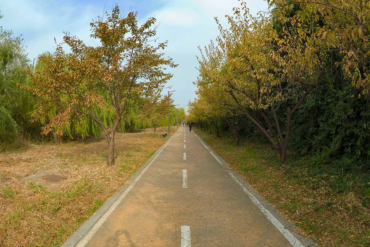
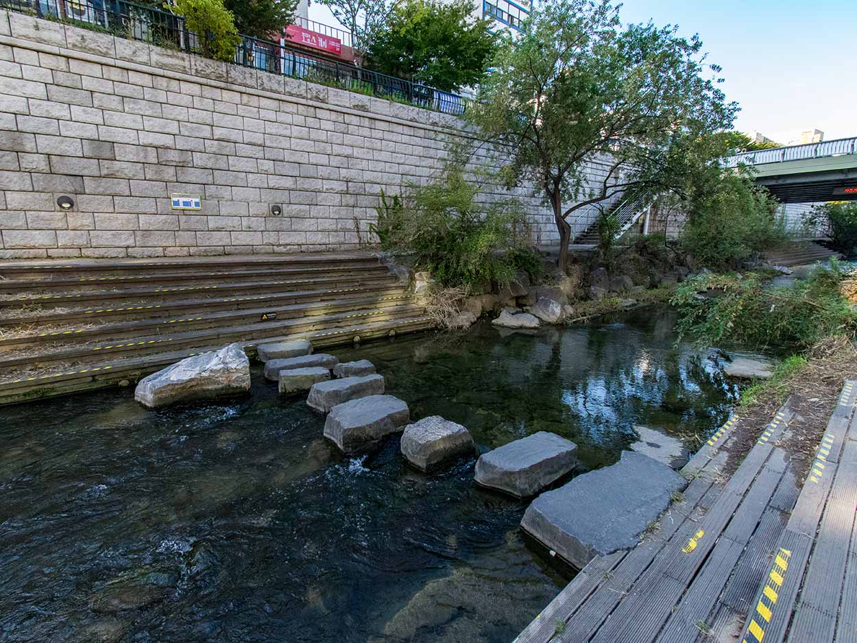
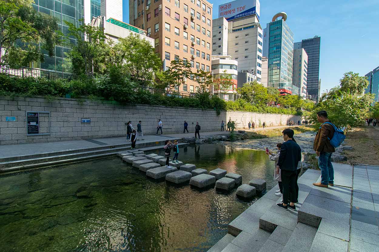
- Grade: Easy. Flat and well maintained. You can cross the stream at many sections along the walk via pedestrian bridges, overhead bridges and stepping stones (watch your footing with these).
Click Here To Read More ...
Click Here To Read More ...
Discovering the Beauty and Renewal of Seoul's Cheonggyecheon Stream, Seoul, South Korea
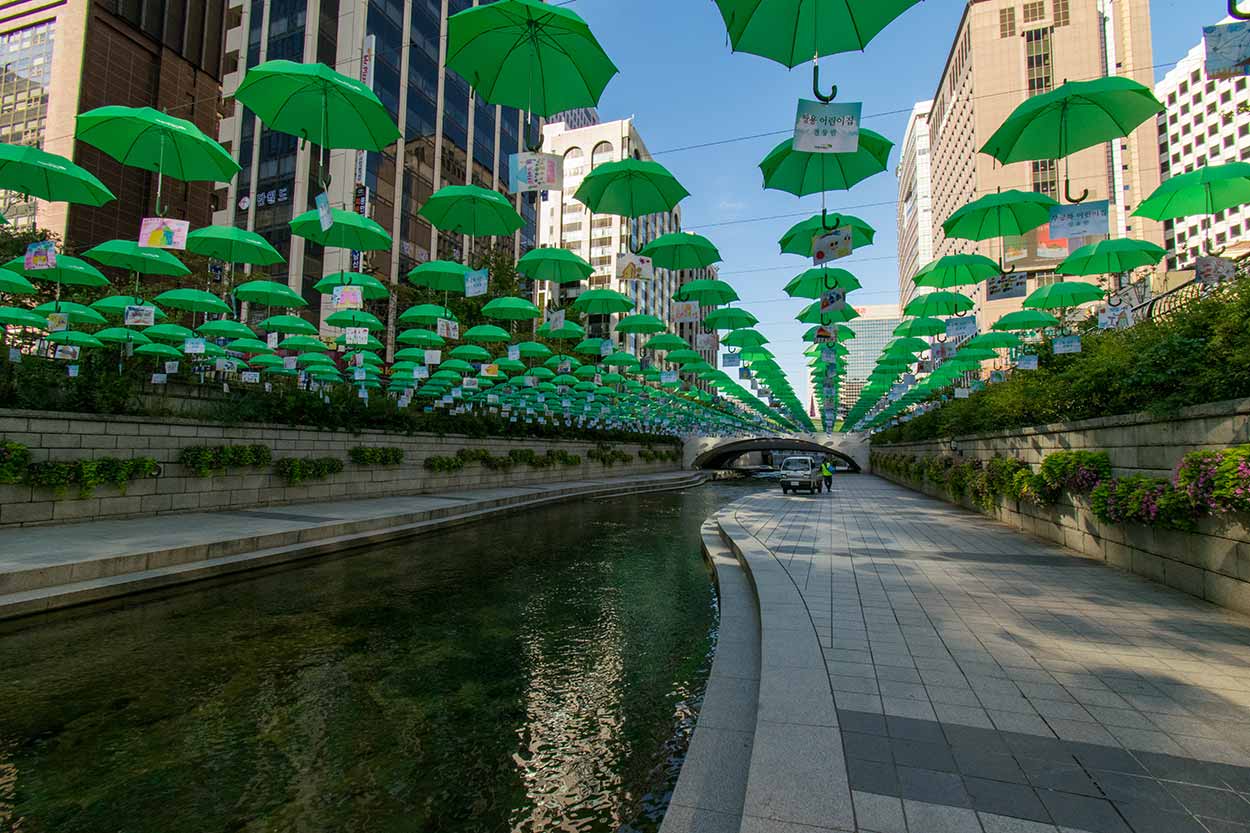
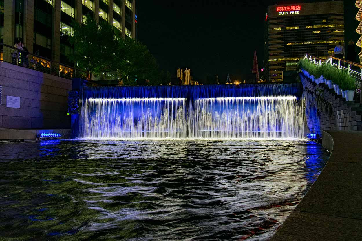
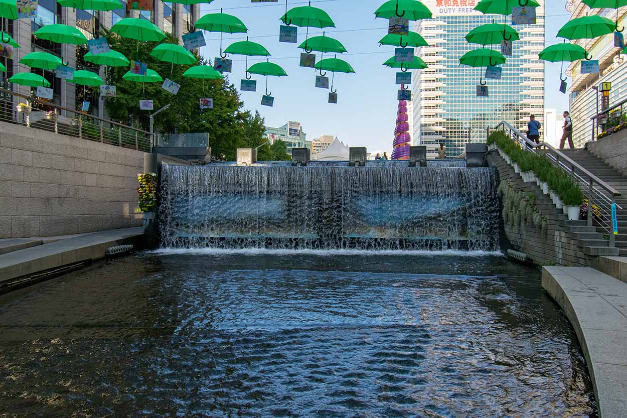
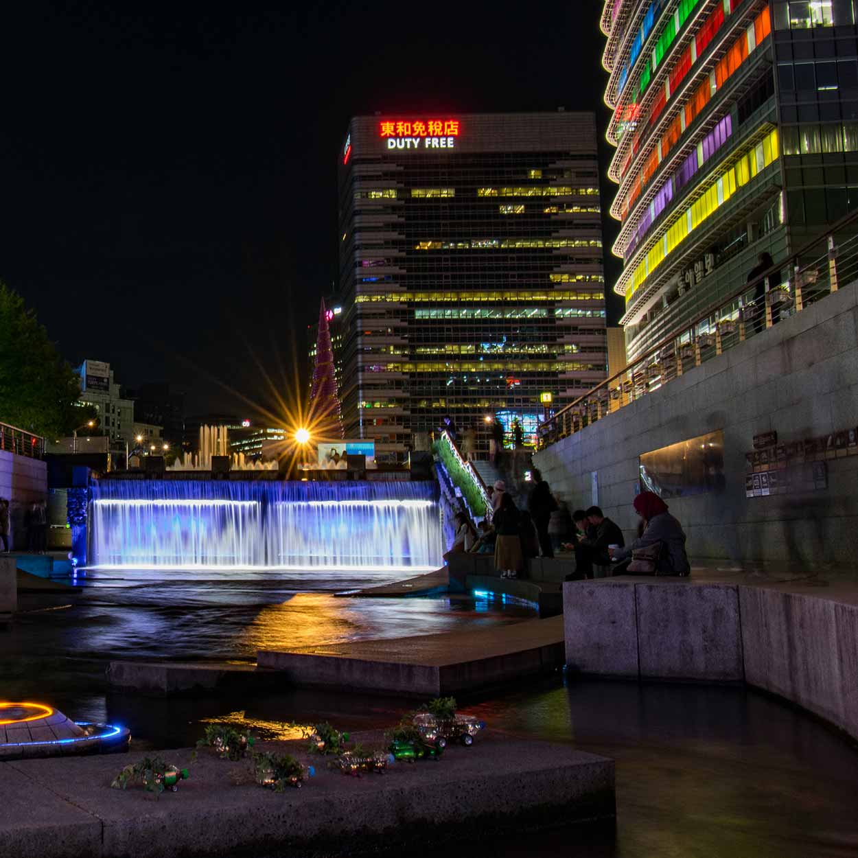
Cheonggyecheon Stream is a scenic waterway that runs through the heart of Seoul, South Korea. Once a polluted and neglected urban wasteland, Cheonggyecheon Stream underwent a major restoration project in the early 2000s, transforming it into one of the city's most popular and beloved public spaces. Today, locals and tourists alike flock to Cheonggyecheon Stream to enjoy its clean waters, picturesque bridges and parks, and stunning lighting displays that change with the seasons. As a symbol of urban renewal and sustainable development, Cheonggyecheon Stream has become an iconic destination that showcases the best of modern Seoul.
Starting near the mouth of Cheonggyecheon Stream and finishing at Cheonggye Plaza, here are some of the highlights of Cheonggyecheon Stream.
Click Here To Read More ...


Q: What is Cheonggyecheon Stream?
A: Cheonggyecheon Stream is a restored waterway that runs through the heart of Seoul, South Korea. It is a popular public space that is known for its clean waters, picturesque bridges, and seasonal lighting displays.
Q: When is Cheonggyecheon Stream promenade open?
A: The promenade is accessible 24/7. However, during rainy days, entry may be limited due to safety concerns.
Q: Where is Cheonggyecheon Stream located in Seoul?
A: Cheonggyecheon Stream is located in the central district of Seoul.
Click Here To Read More ...
Q: How long does it take to walk the length of Cheonggyecheon Stream?
A: It takes about 2-3 hours to walk the entire length of Cheonggyecheon Stream, depending on your pace and how many stops you make along the way.
Q: What subway station can I use to access Cheonggyecheon Stream?
A: Cheonggyecheon Stream is accessible through a total of 11 subway stations including: City Hall Station (Subway Line 1, 2), Jonggak Station, Jongno 3-ga Station, Jongno 5-ga Station, Dongdaemun Station, Dongmyo Station, Sinseol-dong Station (Subway Line 1), Eulji-ro 1-ga Station, Eulji-ro 3-ga Station, Eulji-ro 4-ga Station, Dongdaemun History and Culture Park Station, Yongdu Station (Subway Line 2).
Q: What is the history behind the restoration of Cheonggyecheon Stream?
A: Cheonggyecheon Stream was originally an open sewage canal in the early 20th century. In the 1950s, it was covered over by an elevated highway, which became a symbol of modernization but also caused environmental problems. In the early 2000s, the city of Seoul embarked on a restoration project to remove the highway and restore the stream to its natural state.
Q: What are some of the attractions and landmarks along Cheonggyecheon Stream?
A: Some of the attractions and landmarks along Cheonggyecheon Stream include Gwangtonggyo Bridge, Palseokdam, Jangtonggyo Bridge, and Supyogyo Bridge. There are also several parks and public spaces, including Cheonggye Plaza and Seoul Lantern Festival Square.
Q: What are the best times of year to visit Cheonggyecheon Stream?
A: The best times of year to visit Cheonggyecheon Stream are spring and autumn when the weather is mild and the foliage is at its most beautiful. However, the stream is also popular during the summer for its cool waters and the winter for its stunning lighting displays.
View Photographs
Hello, I'm Marc and welcome to metrotrekker.
Be it seeing the city sights, exploring parklands and gardens, urban walks or day-hikes in the city outskirts, the metrotrekker website details walking routes and hiking trails accessible by foot and public transport in metropolitan areas.
The metrotrekker website provides you with all the details required for metropolitan exploration:
- a map with geolocation and a selection of map types (street, satellite, topographical)
- navigation formats compatible with common GPS devices, desktop browser/software or mobile apps
- trail length and difficulty
- start and finish options (particularly by public transport)
- photos/videos
- attractions or points of interest along the way
- other walks and hikes nearby
- often a story or detailed description of the trail (I have personally walked every single trail on the website)
- a comments section, so feel free to write about your experiences as well
- and more improvements and resources are continually being added
So let's get outside and explore our great metropolitan areas by foot. Click Here to begin exploring with metrotrekker.
Pleasant Trails,
Marc
Links To Help You Navigate